Rusk County Groundwater Conservation District
903-657-1900
  • Home
  • About
    • Board of Directors & Agendas
    • GMA 11
  • Documents
  • Forms
  • Programs
    • Monitoring Programs
    • Aquifer Data Collection & Protection
  • Education
    • District Setting & Topography
    • Geology & Hydrogeology of Rusk County
    • Stratigraphy of Rusk County
    • Groundwater Resources
    • Groundwater Well Education
    • Recharge Enhancement
    • Rainwater Harvesting
    • Water Conservation
    • Youth Education
  • Existing & New Well FAQ
  • Maps
  • Resources
  • Contact

Maps

RCGCD Water Well Management Map


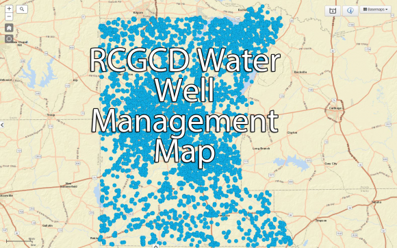
The District has made available its Water Well Management Mapping System.

RCGCD Water Well Management Map for Public Access

Image title

Disclaimer: This product is for informational purposes only and may not have been prepared for or be suitable for legal, engineering, or surveying purposes. It does not represent an on-the-ground survey and represents only the approximate relative location of property boundaries. The Rusk County Groundwater Conservation District expressly disclaims any and all liability in connection herewith. Do not make any business decisions based on this data before validating the information with the original data provider.

RCGCD

Navigation

  • Board of Directors & Agendas
  • GMA-11
  • Documents
  • Forms
  • Monitoring Programs
  • Aquifer Data Collection & Protection
  • District Setting & Topography
  • Geology & Hydrogeology of Rusk County
  • Stratigraphy of Rusk County
  • Recharge Enhancement
  • Rainwater Harvesting
  • Water Conservation
  • Youth Education
  • Existing & New Well FAQ
  • Maps
  • Contact Us

Get In Touch

  • Contact Form
  • 903-657-1900
  • 500 N. High St., Henderson, TX 75652
  • Facebook
© Rusk County Groundwater Conservation District    |    Responsive Website by GroupM7 Design™